
Natural Bridges State Beach
Santa Cruz County, California
The next daylight low tide at Natural Bridges State Beach is predicted for Sunday, November 22, 2026 at about 2:45 PM, reaching -0.4 ft at NOAA's Santa Cruz, Monterey Bay station.
Every picked day listed on this page has passed. The list is worked out again each day.
Tide predictions: NOAA CO-OPS, station 3.7 km (2.3 mi) away.

Picked days in the next 30 days
Local time
-
Low at about 2:45 PM -0.4 ft
Low
Be there about 1:45 PM to 3:45 PM
Sunrise 6:54 AM Sunset 4:54 PM
-
Low at about 3:30 PM -0.9 ft
Low
Be there about 2:30 PM to 4:30 PM
Sunrise 6:55 AM Sunset 4:54 PM
-
Low at about 4:17 PM -1.3 ft
Very low
Be there about 3:17 PM to 4:54 PMEnds at sunset
Sunrise 6:56 AM Sunset 4:54 PM
-
Low at about 2:31 PM -0.1 ft
Low
Be there about 1:31 PM to 3:31 PM
Sunrise 7:06 AM Sunset 4:51 PM
-
Low at about 3:11 PM -0.4 ft
Low
Be there about 2:11 PM to 4:11 PM
Sunrise 7:07 AM Sunset 4:51 PM
-
Low at about 3:48 PM -0.6 ft
Low
Be there about 2:48 PM to 4:48 PM
Sunrise 7:08 AM Sunset 4:51 PM
A low counts at 0.0 ft or lower; very low is -1.0 ft or lower.
Month by month
- November 2026 at Natural Bridges State Beach
- December 2026 at Natural Bridges State Beach
- January 2027 at Natural Bridges State Beach
Later months are in the 2027 calendar for this beach.
Every picked day of 2027 is in the calendar for Natural Bridges State Beach
Best months here
Natural Bridges State Beach has 87 picked days in 2027, and 16 of them are very low.
The most fall in February, March, and April.
Its daylight lows are spread through the year, with no one season far ahead of the rest.
No day is picked in September.
| Month | Picked days | Very low |
|---|---|---|
| January | 9 | 4 |
| February | 15 | 4 |
| March | 13 | 0 |
| April | 11 | 0 |
| May | 10 | 3 |
| June | 9 | 3 |
| July | 4 | 1 |
| August | 1 | 0 |
| September | 0 | 0 |
| October | 3 | 0 |
| November | 5 | 0 |
| December | 7 | 1 |
Where the times come from
Times and heights are NOAA's predictions for its Santa Cruz, Monterey Bay station (9413745), 3.7 km (2.3 mi) from the beach.
The station sits in a bay.
Because the station is not on the open shore, the times and heights on the beach itself can differ from the station's.
NOAA works out this station as an offset from a nearby reference station, so its times are estimates and the windows here say about.
What this page cannot tell you
These are predictions of the astronomical tide. Wind, swell and air pressure move the real water level, and a big swell can cover a low that looks good here.
This page says nothing about what you may find in the pools, whether you may enter or collect, or how to look after yourself on the rocks. California State Parks manages this shore.
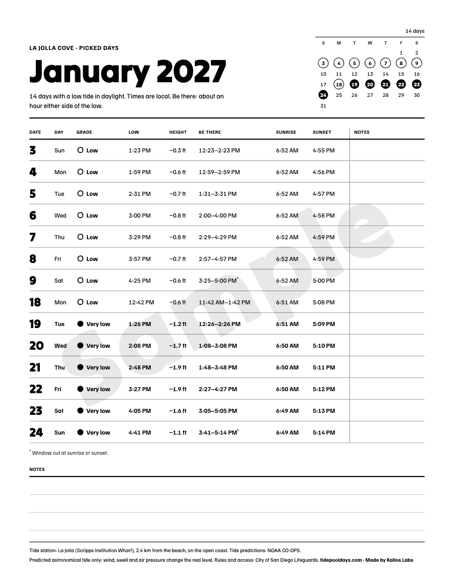
The 2027 calendar for Natural Bridges State Beach
Every picked day of 2027 at this beach, as a PDF to print and pin up and a calendar file for Apple, Google or Outlook.
Get the calendar for Natural Bridges State BeachThe tide numbers are NOAA's and free to everyone, including the next 30 days on this page. What you pay for is the picking and the layout.
Questions about Natural Bridges State Beach
- When is the next daylight low tide at Natural Bridges State Beach?
- The next daylight low tide at Natural Bridges State Beach is predicted for Sunday, November 22, 2026 at about 2:45 PM, reaching -0.4 ft at NOAA's Santa Cruz, Monterey Bay station.
- When is the best time of year for tide pooling at Natural Bridges State Beach?
- Natural Bridges State Beach has 87 picked days in 2027, and 16 of them are very low. The most fall in February, March, and April. Its daylight lows are spread through the year, with no one season far ahead of the rest. No day is picked in September.
- How low does the tide go at Natural Bridges State Beach in daylight in 2027?
- The lowest picked day of 2027 at Natural Bridges State Beach is Sunday, June 6, 2027, with a predicted low of -1.7 ft at about 6:36 AM.
- Which tide station are these times from?
- Times and heights are NOAA's predictions for its Santa Cruz, Monterey Bay station (9413745), 3.7 km (2.3 mi) from the beach. The station sits in a bay.
California State Parks manages this shore. Its page has the rules on entry, collecting and closures; this site does not cover them.
Protected area: A marine protected area.